Yankee Doodle Canyon
The world of Canyoneering is full of difficult routes that require elaborate planning, from hoping for permits to hiring vehicle shuttles, but southern Utah has at least one canyon that is a relief from this madness: Yankee Doodle Hollow. The root of its name seems to be lost in history, but it stuck. Since the popularity of canyoneering increased, this canyon has seen an increasing amount of traffic. Some of the nicest features of this canyon are its lack of a permit system or fees of any kind for non-commercial use, its short approach, and short return hike, making a shuttle vehicle unnecessary. Though it can be crowded at times because of its ease of access, Yankee Doodle Hollow makes for a great quick slot canyon near Saint George.
Geology:
As most slot canyons in southern Utah, Yankee Doodle Hollow is composed of Navajo sandstone. It has been carved by thousands of years of water flowing across and through it. This canyon is also at the base of Pine Valley mountain, the highest point in Washington county, which rises up to an elevation of over 10,300 feet. This mountain absorbs more moisture from clouds than the surrounding, lower desert and this extra moisture flows down the mountain and further erodes the sandstone below. To further exaggerate this erosion, Pine Valley Mountain is made up of Monzonite Porphyry, and littered with limestone and basalt, all of which are harder than the sandstone. These harder rocks get dragged through Yankee Doodle Hollow by flowing watershed, and act like a belt sander, carving the canyon a little deeper every year.
Rating: 3BI**
Gear:
150′ or 2 x 75′ ropes (The longest rappel in the canyon is approximately 75.’)
30-50′ rope (Many people bring a smaller rope for a hand line and belays/rappels for the remaining rappels.)
Dry bag (see “canyon water levels” below)
We do not recommend specific technical gear. Your technical knoiwledge and choice of equipment is entirely your own responsibility. For Canyoneering and Rappelling Lessons, or guided Canyoneering tours, please see our guide website at Paragon Adventures. We would be more than happy to take you through Yankee Doodle Hollow or other slot canyons within the Dixie National Forest, and includes all the equipment needed.
Canyon Water Levels:
This canyon, like all others, has the potential to hold water. Though rain in the area is sparse and the canyon is often very dry, flash floods, as well as water pockets are always possible. Also, like other canyons, sediments are constantly moved with every flood and some deep sections can be filled unexpectedly. They can also be emptied unexpectedly, creating new deep water pockets. In our experience with this canyon, we find that a major sediment level change like this happens AT LEAST once a year. Always enter any water pocket cautiously.
When wet, Yankee Doodle Hollow typically has up to 3 brief sections that require swimming. Two of these can be scrambled, keeping this water at approximately knee-heigth. An additional 2-3 sections can be up to waist deep. At times, water can be up to your chins around every corner.
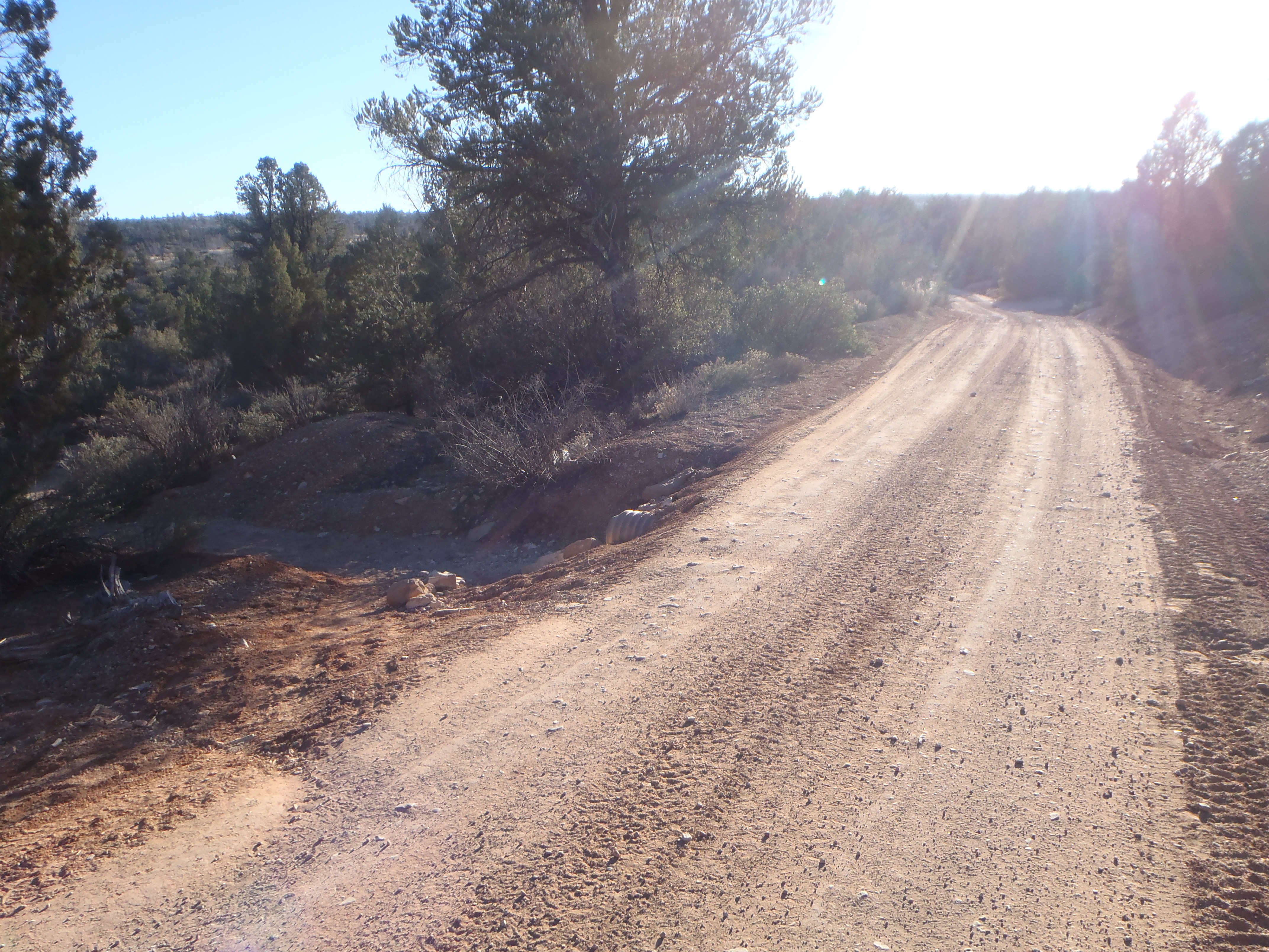
Dirt Road Conditions:
The dirt road to this canyon can become very rough as there is much clay in the soil. It can be especially bad after heavy rains. Trucks can leave deep ruts in this mud, leaving it very torn-up once dried. However, through most of the year, the portion of this road leading to the canyon can be passed by light trucks and even some passenger vehicles (at your own risk).
Driving Directions:
The nearest towns to this canyon are Leeds and Silver Reef, along the interstate 15, approximately 12 miles north of the major Saint George area.
Coming north on the I-15:
Take Exit 22 (Leeds).
Turn left at the stop sign onto Main Street.
Continue straight for approximately 1.5 miles.
Turn left onto Silver Reef Road (under the freeway) after passing the cafe on your left.
Coming south on the I-15:
Take Exit 23.
Turn right onto Silver Reef Road.
Both direction merge here. Please continue.
Continue on Silver Reef Road through the town of Silver Reef. Continue straight for approximately 1.6 miles after getting onto Silver Reef Road (The name will change to Oak Grove Rd., but you will not even notice if you just remain headed straight). At approximately 1.6 miles this road crosses a bridge and turns to a dirt road.
Reset your tripometer or note the mileage as the road becomes dirt.
Stay to the right at the turn right after the bridge. You are now entering Dixie National Forest. Continue straight for approximately 7.0 miles.
Stay to the left at the turn-off to Oak Grove. This turn-off is marked by a wooden sign.
At 7.0 miles, you will see dirt parking spaces on your right. Park in the first one if you can.
You are at the trail head. Get ready for the canyon.
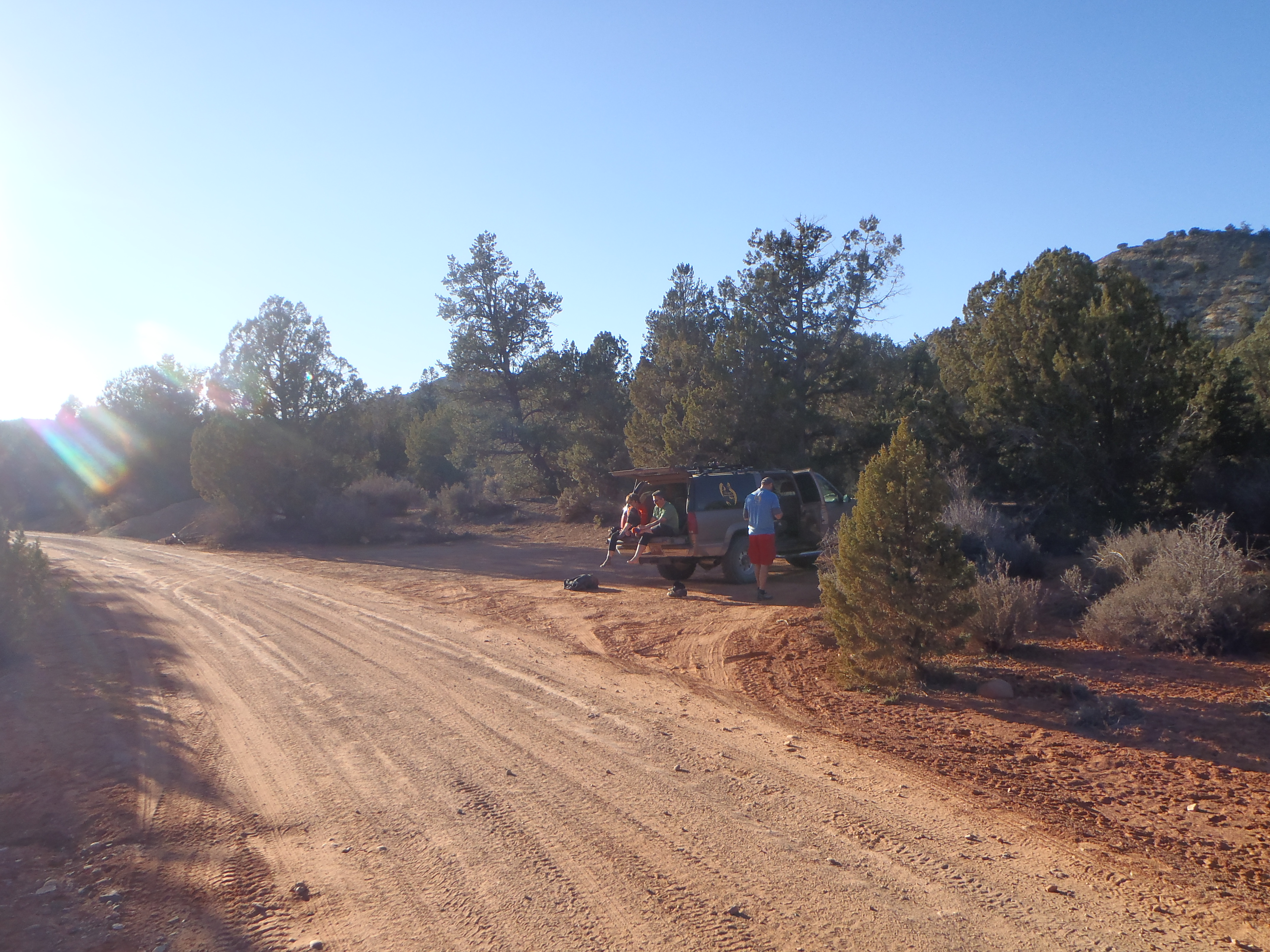
This is the largest of the parking spaces closest to the trailhead.
Approach:
From the first parking space, walk south along the road until you see a metal water culvert (pipe) buried under the road but exposed on the sides of the road.
Walk left off of the main dirt road at this culvert to find the short hiking trail leading to the canyon.
At this culvert, walk left down the wash about 20-30′.
Turn right onto the beaten hiking trail and follow it for approximately 300 feet until it drops down into the wash. This wash is Yankee Doodle Hollow.
Walk left down the wash and immediately on your right are two anchors. About 20 feet further down the wash, you can see the beginning of the slot canyon.
Canyon:
From the top anchors, you have three options.
1) Rappel off these anchors into the head of the canyon.
2) Hike along the left side of the slot until you reach the gulley that you can scramble down to get into the slot. (The tree at the top of this gulley is strong and sound and can be used as an anchor for a hand line if required for this gulley.)
3) Some people choose to rappel off of trees on either side of the canyon.
The next rappel you reach is the longest approximately 75 feet tall. There are two anchors with chains on the left. Please be courteous with other peoples gear, as many will leave their long ropes here while they continue the canyon since the remaining rappels do not require as long of a rope.
All other rappels/drops can be scrambled by the avid canyoneer, but there are many single anchors for hand lines at these drops.
Exits:
1st Exit (Emergency only):
There is one gulley that can be scrambled out of on the left, but it is borderline fifth-class climbing. If you choose to attempt an early exit, (you better have a real reason) choose carefully and climb with the necessary protection.
2nd Exit:
As the canyon opens up, there is a sloping scramble on your left.
This can be identified as being right after the semi-arch on your right. There is a lot of broken stone from rock falls here. Across on the left side of the canyon, you should be able to see rubber marks on the red rock sloping up the hill.
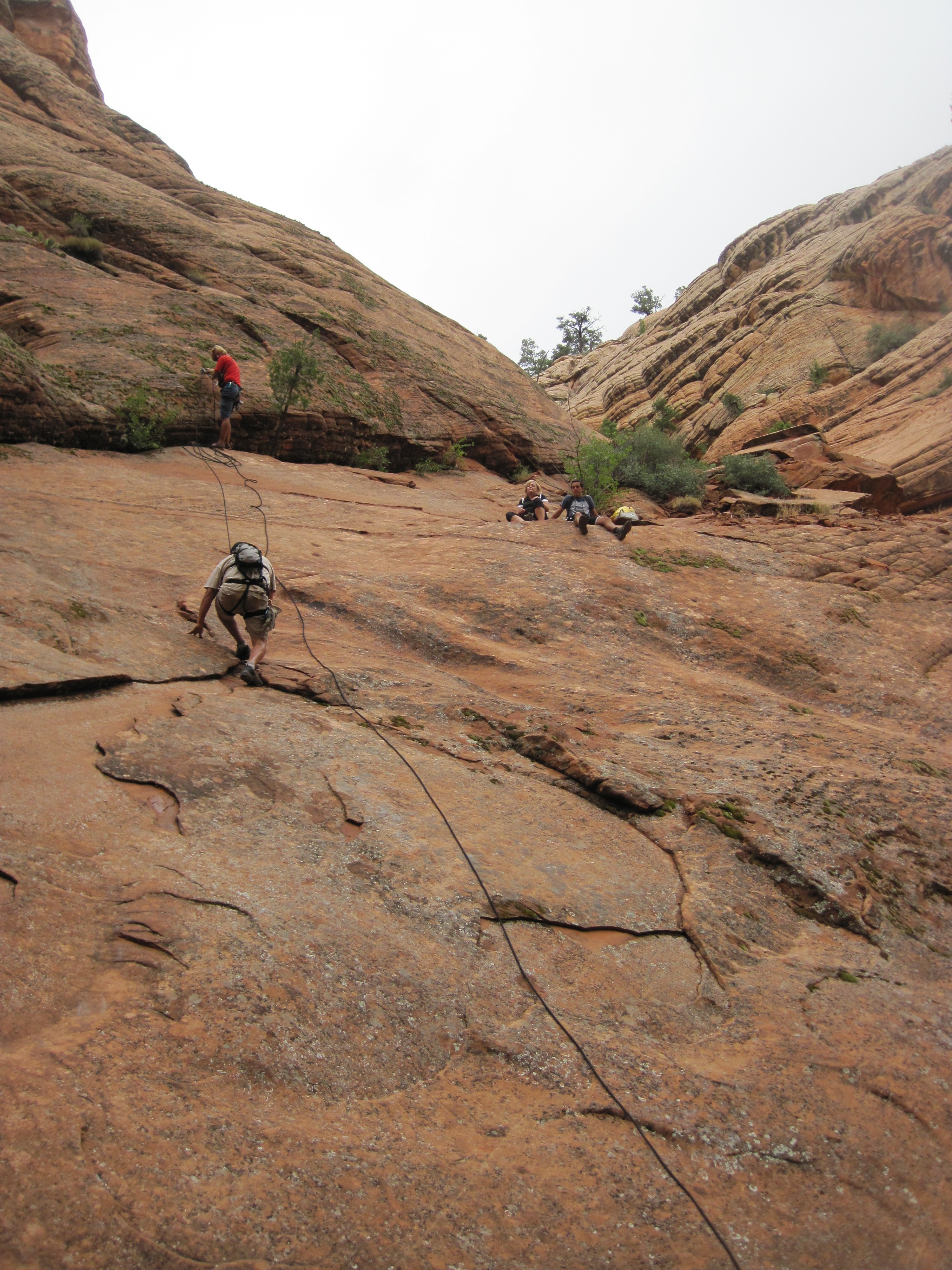
This exit (Exit 2) scramble is about 1/4 mile before the end of Yankee Doodle Hollow, so if you miss it and you reach the end of the canyon where it turns into Heath Wash, you are still close enough to turn around and look for this spot. Scramble up where you see the climber then hike up the gulley (behind the bushes, behind the sitting people.)
Follow the path in the photo as it leads you up and to the right and onto a dirt path. Follow this path or the wash itself (since the trail splits and forks) uphill until you reach the dirt road. Follow the road to the left for less than 1/4 mile to the parking spots.
3rd Exit:
If you pass the scramble out, or don’t want to attempt it, continue hiking down the canyon until it ends and feeds into a different wash (locally called “Big Hollow,” if you turn right down this canyon it becomes Heath Wash and leads into Red Cliffs National Recreation Area. Don’t turn right here.)
Hike left up this wash until it meets the dirt road. Hike left along the road for approximately 0.8 of a mile to the parking spaces.
4th Option:
If at least one person is capable of scrambling out at Exit#2, but the rest are not, give this person the keys to a vehicle and have that person scramble out and drive the vehicle back towards Silver Reef for 0.8 miles, stopping at the sharp bend in the road here. The rest of the group continues to Exit#3, where they will meet the driver at the dirt road.